지도 및 장소
컬렉션을 사용해 정리하기
내 환경설정을 기준으로 콘텐츠를 저장하고 분류하세요.

사용자가 Google에서 제공하는 풍부한 지도로 세계를 탐험할 수 있습니다.
맞춤 마커로 위치를 식별하고, 이미지 오버레이로 지도 데이터를 보강하며, 하나 이상의 지도를 프래그먼트로 삽입하고 주변 관심 장소에 대한 세부정보를 표시하는 등 다양한 작업을 할 수 있습니다.
지도 SDK
Android용 Maps SDK는 Google Play 서비스 플랫폼의 일부이며
지도와 맞춤설정된 지도 정보를 앱에 포함할 수 있습니다. 시작하기 가이드에 따라 프로젝트에서 Google Play 서비스를 설정한 후
Maps SDK의 주요 기능을 자세히 알아보세요.
앱에 지도 추가
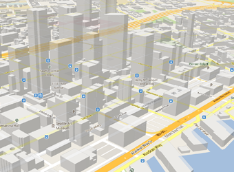
Android용 Maps SDK를 사용하면 XML 스니펫을 사용하여 지도를 활동에 프래그먼트로
삽입할 수 있습니다. 이 SDK는 3D 지도, 실내/위성/지형/하이브리드 지도, 효율적인 캐싱과 그리기를 위한 벡터 기반 타일, 애니메이션 전환 등 흥미로운 기능을 제공합니다. 지도 객체를 추가하는
방법에 대해 알아보세요.
지도 사용자설정
지도에 아이콘을 추가하여 사용자의 특별한 관심 장소를 표시할 수 있습니다.
앱의 디자인과 분위기에 어울리도록 지도 마커의 맞춤 색상이나 아이콘을 정의할 수 있습니다. 앱을 더 개선하려면 다중선과 다각형을 그려 경로나 지역을 표시하거나 완전한 이미지 오버레이를 제공합니다. 마커를 그리는 방법에 관한
가이드에서 자세히 알아보세요.
사용자 뷰 제어
지도의 '카메라' 시점의 회전, 기울기, 확대/축소, 화면 이동 속성을 제어하는 기능으로 사용자가 세상을 바라볼 수 있게 하세요.
보기 변경 방법을 알아보세요.
앱에 스트리트 뷰 추가
활동에 스트리트 뷰를 추가하면 사용자가 360도 파노라마 뷰를 통해 세계를 탐험할 수 있습니다. 스트리트 뷰 카메라의 확대/축소와 방향 (기울기 및 방위)을 프로그래매틱 방식으로 제어하고 지정된 시간 동안 카메라 움직임을 애니메이션으로 보여줍니다.
Places API
사용자가 현재 위치를 기반으로 비즈니스, 음식점, 기타 관심 장소를 찾을 수 있도록 도와주세요. Android용 Places SDK를 사용하면
사용자가 필요로 하는 연락처 정보, 영업시간 등
편리하고 관련성 높은 정보를 제공할 수 있습니다.
이 페이지에 나와 있는 콘텐츠와 코드 샘플에는 콘텐츠 라이선스에서 설명하는 라이선스가 적용됩니다. 자바 및 OpenJDK는 Oracle 및 Oracle 계열사의 상표 또는 등록 상표입니다.
최종 업데이트: 2025-07-27(UTC)
[null,null,["최종 업데이트: 2025-07-27(UTC)"],[],[],null,["# Maps and places\n\nAllow your users to explore the world with rich maps provided by Google.\nIdentify locations with custom markers, augment the map data with image\noverlays, embed one or more maps as fragments, show details about nearby points\nof interest, and much more.\n\nMaps SDK\n--------\n\nThe [Maps SDK for Android](https://developers.google.com/maps/documentation/android-sdk/) is part of the Google Play services\nplatform and lets you include maps and customized mapping information in your\napp. Follow the [Get Started](https://developers.google.com/maps/documentation/android-sdk/start) guide to set up Google Play services\nin your project, then dive into the key features of the Maps SDK.\n\n#### Add a map to your app\n\nWith Maps SDK for Android, you can embed maps into an activity as a fragment\nusing an XML snippet. This SDK offers exciting features such as 3D maps;\nindoor, satellite, terrain, and hybrid maps; vector-based tiles for efficient\ncaching and drawing; animated transitions; and much more. Learn about how to\n[add a map object](https://developers.google.com/maps/documentation/android-sdk/map).\n\n#### Customize the map\n\nAdd markers onto the map to indicate special points of interest for your users.\nYou can define custom colors or icons for your map markers to match your app's\nlook and feel. To further enhance the app, draw polylines and polygons to\nindicate paths or regions, or provide complete image overlays. Learn more in the\nguide about how to [draw markers](https://developers.google.com/maps/documentation/android-sdk/marker).\n\n#### Control the user's view\n\nGive your users a different view of the world with the ability to control the\nrotation, tilt, zoom, and pan properties of the \"camera\" perspective of the map.\nLearn how to [change the view](https://developers.google.com/maps/documentation/android-sdk/views).\n\n#### Add Street View to your app\n\n[Add Street View](https://developers.google.com/maps/documentation/android-sdk/streetview) into an activity and let your users explore\nthe world through panoramic 360-degree views. Programmatically control the zoom\nand orientation (tilt and bearing) of the Street View camera, and animate the\ncamera movements over a given duration.\n\nPlaces API\n----------\n\nHelp your users find businesses, restaurants, and other points of interest based\non their current location. Use the [Places SDK for Android](https://developers.google.com/maps/documentation/places/android-sdk)\nto provide convenient, relevant information like contact information and\nbusiness hours when your users need it."]]